![](/images/other/stat-length.png)
![Trail Walking La Terrasse - Belvédère du Puy et moulin de Porte-Traine - Photo](https://media.geolcdn.com/t/1900/400/409666e6-b4af-4549-812a-5adf6d36ae46.jpg&format=pjpeg&maxdim=2)
Belvédère du Puy et moulin de Porte-Traine
GuyVachet
User
![Length](/images/other/stat-length.png)
![Max alt](https://static1.geolcdn.com/siteimages/upload/files/1508320355ic_sort_altitude_max_24dp.png)
![Uphill gradient](https://static1.geolcdn.com/siteimages/upload/files/1508320355ic_sort_den_pos_24dp.png)
![Km-Effort](/images/other/stat-length.png)
![Min alt](https://static1.geolcdn.com/siteimages/upload/files/1508320355ic_sort_altitude_min_24dp.png)
![Downhill gradient](https://static1.geolcdn.com/siteimages/upload/files/1508320355ic_sort_den_neg_24dp.png)
![Boucle](https://static1.geolcdn.com/siteimages/upload/files/16400158638029165_repeat_loop_refresh_sync_direction_icon.png)
![Walking](https://static1.geolcdn.com/sitytour/trail-icons/101.png)
5h42
Difficulty : Difficult
![Scan this QR Code to open this trail in the SityTrail application](https://capi.geolives.com/qq0zvz2zws4bq2lad0pu/sitytour/trails/2356437/qr.png?size=200)
FREE GPS app for hiking
About
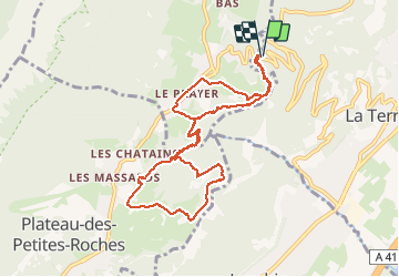
Trail Walking of 10.8 km to be discovered at Auvergne-Rhône-Alpes, Isère, La Terrasse. This trail is proposed by GuyVachet.
Description
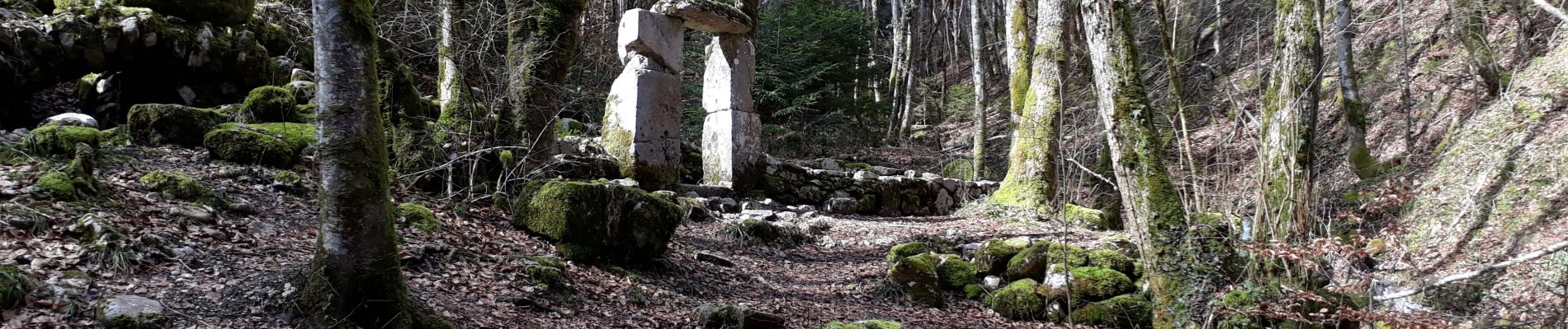
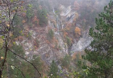
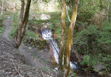
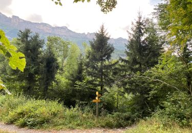
Exploration du Plateau des Petites Roches entre St-Hilaire du Touvet et St-Bernard pour découvrir le Belvédère du Puy avec un superbe panorama sur le Grésivaudan dominé par Belledonne. La descente qui suit peut être délicate si le terrain est gras ainsi que le franchissement du 1er ruisseau en dessous des Pelloux s'il y a beaucoup d'eau. La suite est sans histoire pour l'ancien moulin de Porte-Traine avec de nouveaux passages en crête sans souci.
Positioning
Comments
Trails nearby
![Trail Walking La Terrasse - Les Cascades du Glesy et le Belvédère du Puy - Photo](https://media.geolcdn.com/t/375/260/ext.jpg?maxdim=2&url=https%3A%2F%2Fservices.sitytrail.com%2FGeolivesWS%2FDownloadMedia.ashx%3FTrailID%3D859792%26Media%3Dfix__20171109135601.jpg)
![Walking Walking](https://static1.geolcdn.com/sitytour/trail-icons/101.png)
Walking
![](/images/other/stat-length.png)
![](https://static1.geolcdn.com/siteimages/upload/files/16400158638029165_repeat_loop_refresh_sync_direction_icon.png)
![Trail Walking Plateau-des-Petites-Roches - Piton et Dôme de Bellefont - Photo](https://media.geolcdn.com/t/375/260/ext.jpg?maxdim=2&url=https%3A%2F%2Fservices.sitytrail.com%2FGeolivesWS%2FDownloadMedia.ashx%3FTrailID%3D101446%26Media%3D1519_1.jpg)
![Walking Walking](https://static1.geolcdn.com/sitytour/trail-icons/101.png)
Walking
![](/images/other/stat-length.png)
![](https://static1.geolcdn.com/siteimages/upload/files/16400158638029165_repeat_loop_refresh_sync_direction_icon.png)
![Trail Walking Saint-Pierre-de-Chartreuse - pas de rochebrune et de rocheplane - Photo](https://media.geolcdn.com/t/375/260/643b9872-5358-4c95-b9d7-43cb72f88471.jpg&format=jpg&maxdim=2)
![Walking Walking](https://static1.geolcdn.com/sitytour/trail-icons/101.png)
Walking
![](/images/other/stat-length.png)
![](https://static1.geolcdn.com/siteimages/upload/files/16400158638029165_repeat_loop_refresh_sync_direction_icon.png)
![Trail Walking Saint-Pierre-de-Chartreuse - tour de la Dent de crolles par des sangles - Photo](https://media.geolcdn.com/t/375/260/9e1abd5a-85a3-461c-ab6a-25f1470ccefa.jpg&format=jpg&maxdim=2)
![Walking Walking](https://static1.geolcdn.com/sitytour/trail-icons/101.png)
Walking
![](/images/other/stat-length.png)
![](https://static1.geolcdn.com/siteimages/upload/files/16400158638029165_repeat_loop_refresh_sync_direction_icon.png)
![Trail Walking Plateau-des-Petites-Roches - Dent de Crolles tour - Photo](https://media.geolcdn.com/t/375/260/ext.jpg?maxdim=2&url=https%3A%2F%2Fstatic1.geolcdn.com%2Fsiteimages%2Fupload%2Ffiles%2F1553511878bg_sport_marche.png)
![Walking Walking](https://static1.geolcdn.com/sitytour/trail-icons/101.png)
Walking
![](/images/other/stat-length.png)
![](https://static1.geolcdn.com/siteimages/upload/files/16400158638029165_repeat_loop_refresh_sync_direction_icon.png)
![Trail Walking La Terrasse - 38 croix coquet - Photo](https://media.geolcdn.com/t/375/260/b4142c47-b708-48d1-bde5-f071ad1815cd.jpg&format=jpg&maxdim=2)
![Walking Walking](https://static1.geolcdn.com/sitytour/trail-icons/101.png)
Walking
![](/images/other/stat-length.png)
![](https://static1.geolcdn.com/siteimages/upload/files/16400158638029165_repeat_loop_refresh_sync_direction_icon.png)
![Trail Walking Saint-Pierre-de-Chartreuse - Dent de Crolles depuis Perquelin - Photo](https://media.geolcdn.com/t/375/260/ext.jpg?maxdim=2&url=https%3A%2F%2Fstatic1.geolcdn.com%2Fsiteimages%2Fupload%2Ffiles%2F1553511878bg_sport_marche.png)
![Walking Walking](https://static1.geolcdn.com/sitytour/trail-icons/101.png)
Walking
![](/images/other/stat-length.png)
![](https://static1.geolcdn.com/siteimages/upload/files/16400158638029165_repeat_loop_refresh_sync_direction_icon.png)
![Trail Walking Plateau-des-Petites-Roches - Cascade du Douix - Photo](https://media.geolcdn.com/t/375/260/3a1b7b7d-55bf-4975-b1cc-5364380d6d1a.jpg&format=jpg&maxdim=2)
![Walking Walking](https://static1.geolcdn.com/sitytour/trail-icons/101.png)
Walking
![](/images/other/stat-length.png)
![](https://static1.geolcdn.com/siteimages/upload/files/16400158638029165_repeat_loop_refresh_sync_direction_icon.png)
![Trail Walking Plateau-des-Petites-Roches - Cabane de l'Aulp du Seuil au part du col de Marcieu - Photo](https://media.geolcdn.com/t/375/260/2eee0c8f-e00c-49d7-8e11-2f874442064a.jpg&format=jpg&maxdim=2)
![Walking Walking](https://static1.geolcdn.com/sitytour/trail-icons/101.png)
Walking
![](/images/other/stat-length.png)
![](https://static1.geolcdn.com/siteimages/upload/files/16400158638029165_repeat_loop_refresh_sync_direction_icon.png)